New Town Korat: Spatial analysis for preferable location identification
Location: Nakhon Ratchasrima (Korat), Thailand
Year of work: 2020-21
Role: Data Analytic Consultant
In collaboration with: Planner26, Urban Design and Development Center (UDDC)
Commissioned by: Department of Public Works and Town & Country Planning, Thailand
The long-term New Town Korat development plan in Thailand is part of the 20-Year National Strategic Plan of Thailand. P26, the consultant, proposes for the project to use future scenarios as part of the initial participatory process. As the lead analyst for this process, a mathematical formula is developed to flexibly analyze all variable layers under the 2x2 alternative future scenarios. The two axes of alternative scenarios are 1) monocentric or polycentric and 2) agricultural-led or industrial-led development. From such a premise, a series of seive analyses is devised under the aforementioned formula to arrive at 4 scenarios of preferable land use potentials.
Methodology
To achieve flexible output scenarios, a mathematical framework is designed to guide spatial analytical processes using a 1 sq.km. unit of analysis. This formula is based on the conceptual framework that a suitability (Y) of a given landuse in a given scenario is a product of 1) a unionization of restricted area of variable layers that are illegal to be used (R); 2) a product of all risk variables (r); and 3) a summation of preferable variable (x) weighted by different preference level of each land use (w).
A total of 16 suitability maps of commercial, residential, industrial, and agricultural land use for all 4 scenarios. Within each scenario, the four land use types are overlaid upon one another based on the bid-rent theory (von Thünen), whereby the commercially preferable land use will outbid the residential, the industrial, and the agricultural land use respectively.

Gradient of combined risk factors
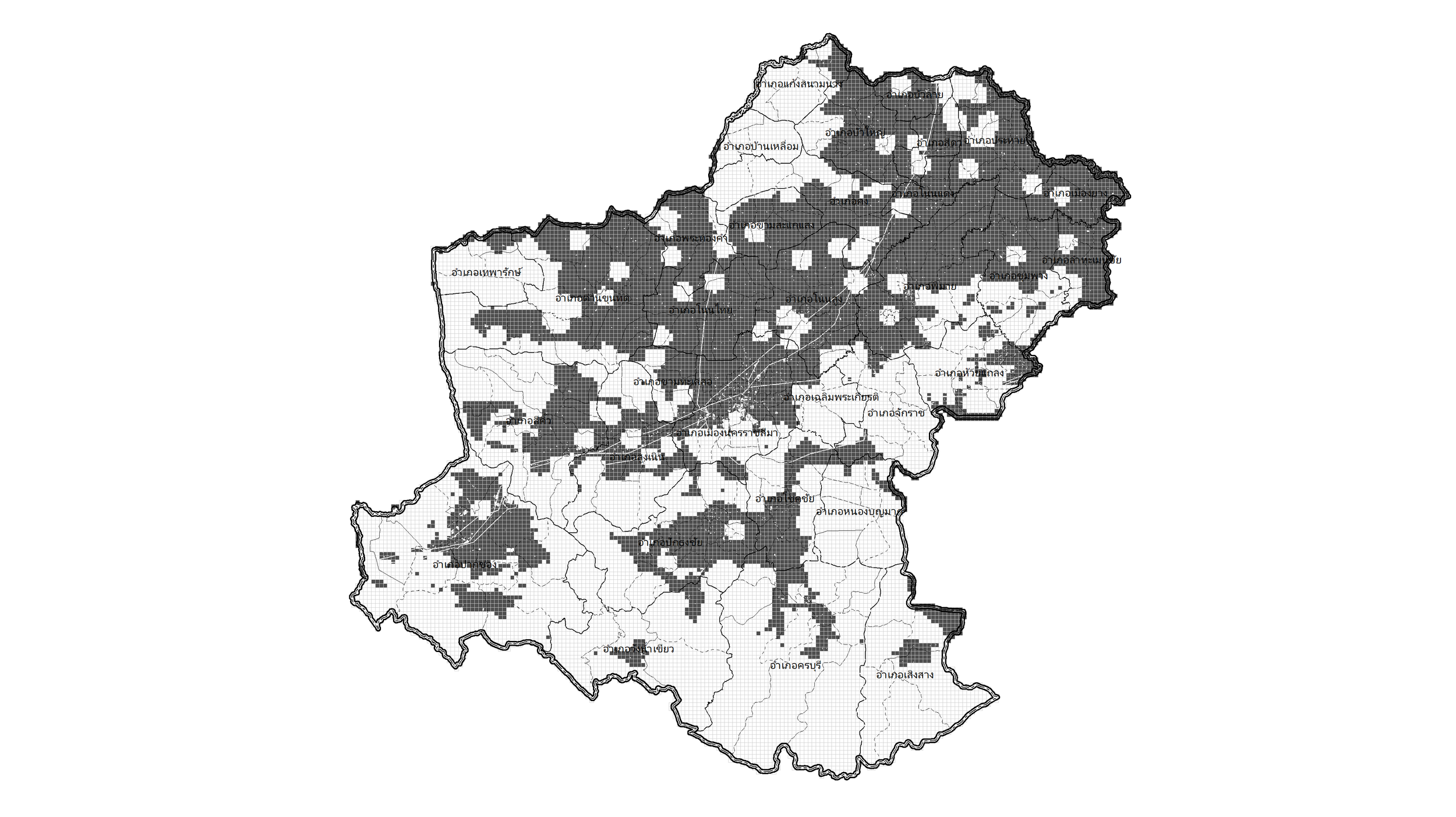
Combined legally restrictive areas

Integrating analysis result with provincial development plan
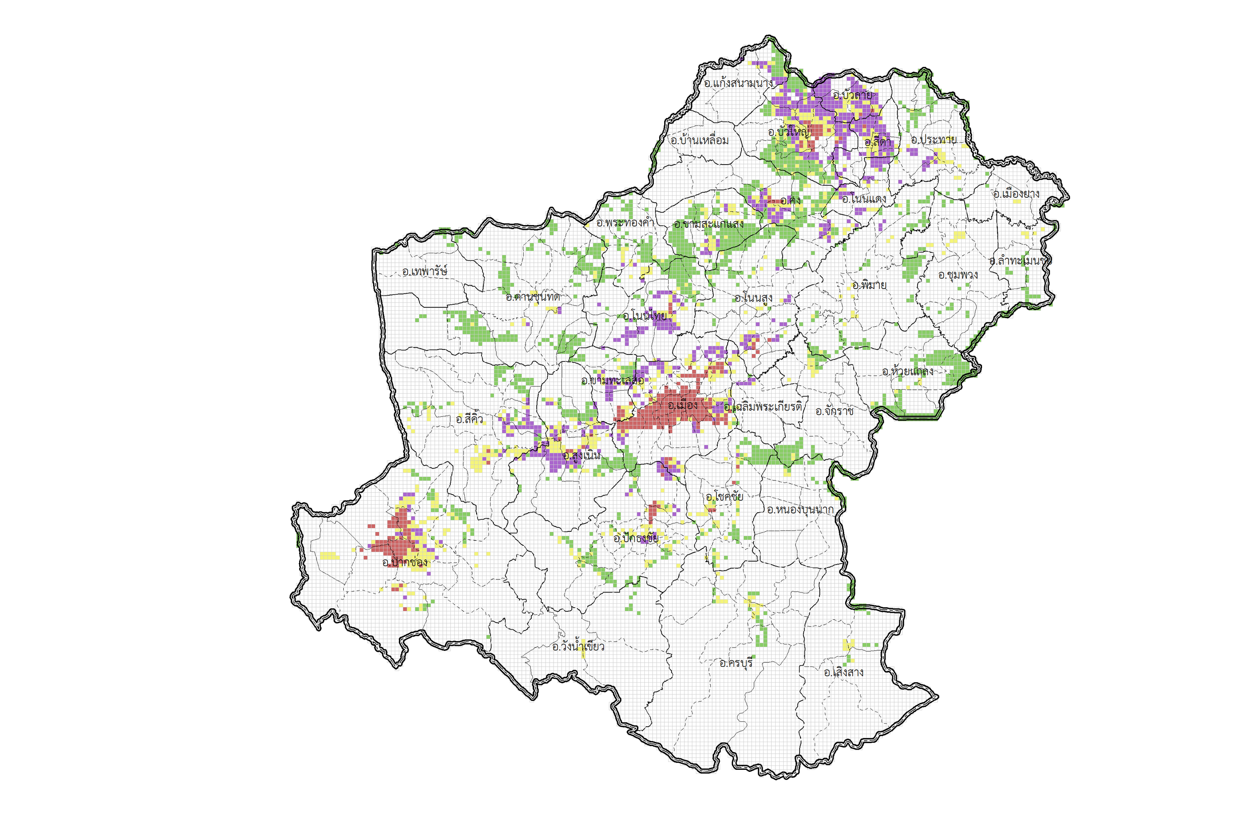
Potential development sites under a scenario by land use: agricultural (g), residential (y), industrial (p), and commercial (r) lands.
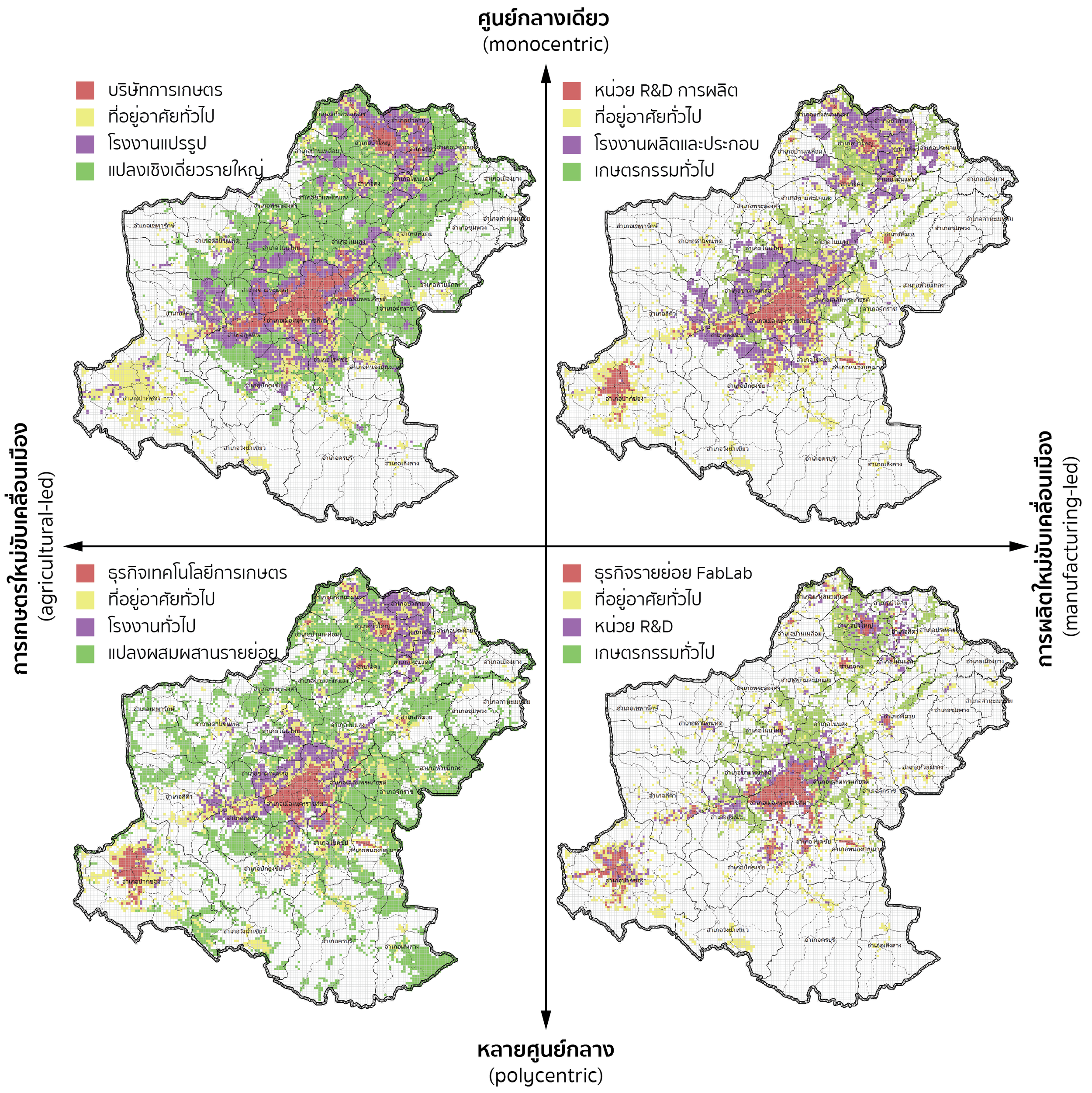
Comparison of potential land use development under 4 plausible scenarios.
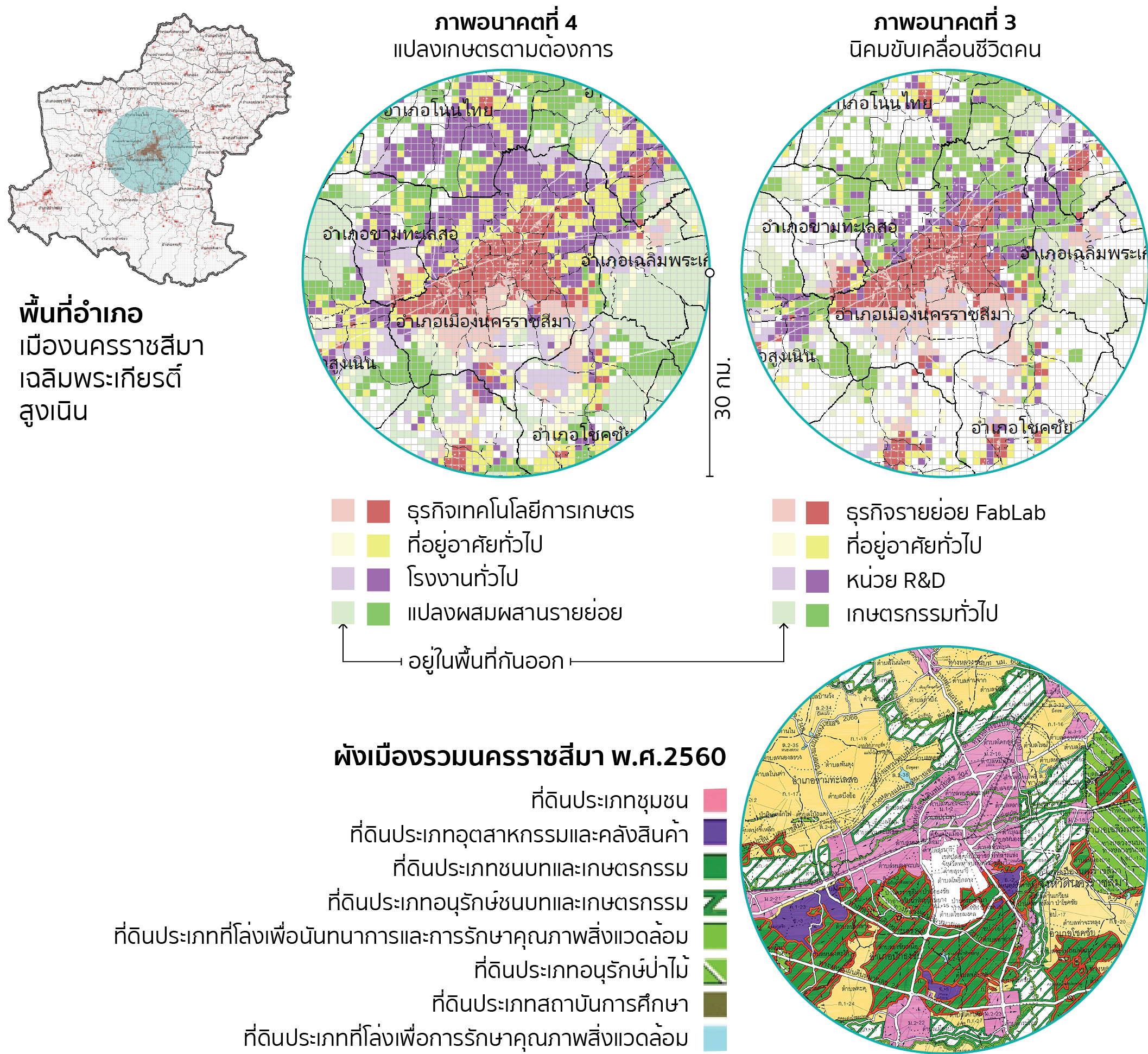
Integrating analysis result with land use plan